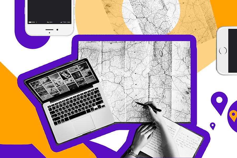
There have been times when we were afraid to get lost in a strange city or had difficulties looking for a certain place, whether it be a store, restaurant, or something else. Today these problems are in the past, and we owe it all to our mobile devices. To be more specific, we should thank the geolocation feature which not only simplifies our lives in many ways but also allows us to strengthen our business.
We'll discuss the issue in detail in our article which will tell you how to make a GPS app, and why you need such a geolocation service. And we’ll share our own experience in the field of GPS application development.
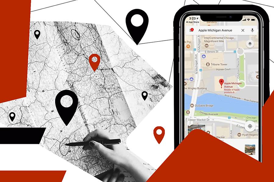
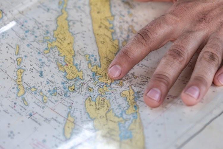
What is a geolocation service?
Before figuring out how to build a GPS app, you need to understand its essence and purpose in the first place.
In fact, GPS mobile applications are among geolocation services whose functions are based on user location data.
#1. Apps with notifications in specific locations
Such GPS mobile applications are effective to implement loyalty programs for various companies. Say, a service of the sort may provide users with the opportunity to earn points when visiting certain locations. Later these points, in turn, can be exchanged for discounts or gift coupons. This is what Shopkick does: it awards users when they visit specific stores.
So if you own a chain of shops, pharmacies, restaurants (whatever) and want to promote one of the outlets (or even a few of them), you should think about GPS tracking app development.
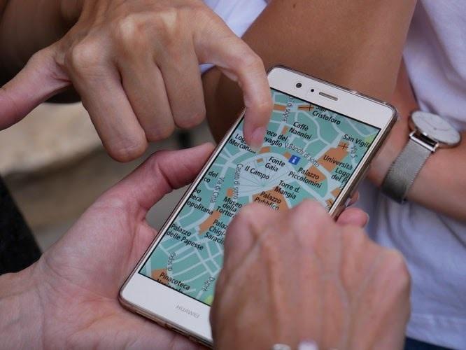
#2. Apps to find different places and services
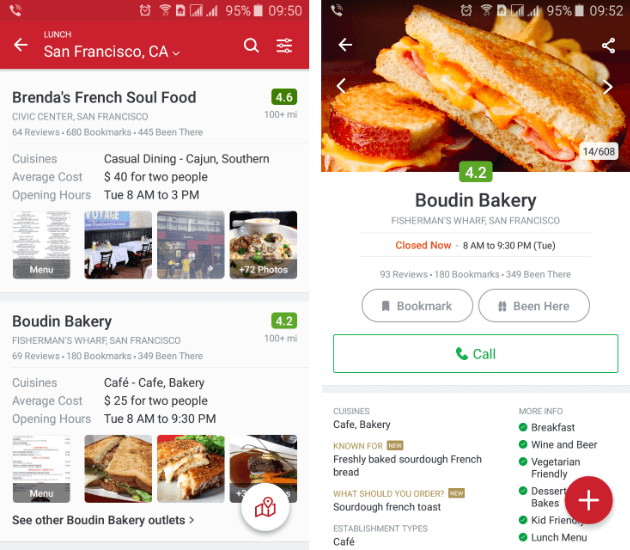
Striking examples of popular GPS apps are Zomato and Foursquare. These applications allow us to view the offers of the nearest restaurants (menus, photos, and reviews). It is useful both to owners of places to dine and to perspicacious businessmen who want to create GPS apps to increase their earnings (through advertising, paid exclusive features, etc).
#3. Apps to find people
The category includes not only services to track the location and movement of friends, but also dating apps, the same Tinder (which really belongs to the top 10 GPS apps of this type).

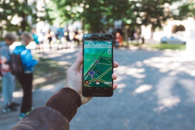
#4. Games with geolocation
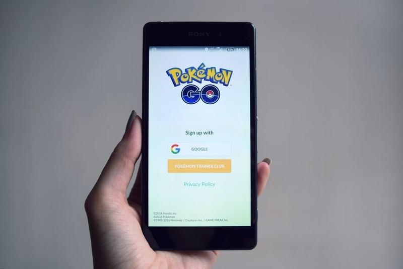
Well, the games industry couldn’t ignore the geolocation feature either. And the best GPS application of the sort is, of course, Pokémon GO.
Obviously, the creation of games, especially those related to the AR/VR effect, is not an easy task (which means it is an expensive one). But if the game turned out to be exciting, there is a chance of making it popular, so it'll be successful and profitable. Therefore, the cost of GPS app development can pay off with interest.

GPS apps ideas
Let's discuss how you can use the geolocation feature - it's important if you want to create the best GPS application able to benefit your business. So…
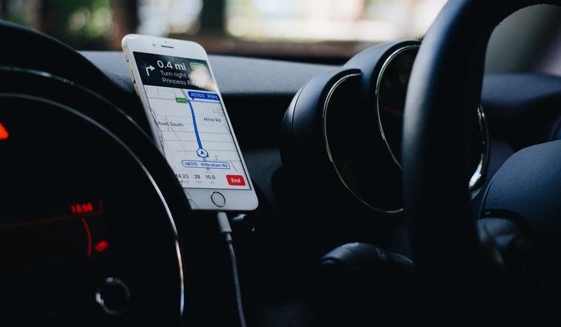
#1. Transport services
Competition among transport companies is becoming more and more burning day by day. That’s why you should find new opportunities to scale your business and reduce costs. One of these opportunities is GPS tracking application development because all market leaders have their own GPS apps for driving.
Such a GPS monitoring system is especially important when it comes to:
-
Taxi services. Thanks to the geolocation feature, dispatchers will be able to track the specific location of the driver. The customer ordering a taxi will also have a chance to see how many cars are nearby, and how far away his driver is. So if your business is closely related to a taxi service, be sure to figure out how to make a GPS app (that is, how to supplement your taxi app with the geolocation feature).
-
Shipping, courier delivery. By creating a geolocation feature, you’ll be able to effectively monitor cargo transportation, delivery of goods, as well as track the location and speed of vehicles in real-time.
#2. Content related to a specific location
We mean a GPS application for Android and iOS whose content is only available in certain places. Let’s recall Snapchat which offers users the Geofilters feature which allows making snaps supplemented with a specific pattern typical for a particular location. Many brands take advantage of such an opportunity to popularize their services - the same McDonald's has a set of excellent geofilters that Snapchat users can enjoy while dining in its establishments.
You can think about GPS application development either and create an app like Snapchat. In our article, we've described all the details on this matter.
#3. Warning about dangerous situations
You can also create an application with GPS in order to send users notifications about possible dangerous situations near them (like natural disasters, fires, armed clashes, etc). The service gathers negative news and reports to people what is happening in their immediate vicinity.
#4. Automating tasks
People love it when someone else performs boring routine actions (or at least helps to perform them) instead of them since a lot of such actions are associated with a certain location (say, a man's used to calling home when he is in a particular store). So services with such a feature will be in high demand, and you may consider creating one of them (namely, consider GPS tracking app development), because it could certainly be a profitable investment.
Examples of programs of the sort already exist, and Trigger is obviously among the top 10 GPS apps. It allows sending notifications when a person leaves the office in the evening. Its interface is user-friendly but so far it only works on the Android platform.
#5. Relaxation, entertainment, and recreation
How to build a GPS app helping people relax and rest with maximum comfort and minimum hassle? Believe us, everything is quite simple: such an application must determine the user's location and tell him what places nearby should be visited. These can be restaurants with nice cooking, shopping and entertainment centers, famous sights, stores with bargain sales, and so on.
By taking advantage of the geolocation feature, you can provide your customers with a lot of possibilities: discount coupons, weather forecasts, news about sports events, or concerts they would be interested in (given their location).
As you can see, there are plenty of ideas for apps that use GPS. In fact, any application can greatly benefit from such a feature.
What to consider during GPS application development
If you want your mobile service to join the top 10 GPS apps, you need to remember that there are a number of points requiring special attention:
-
High app performance. Your mobile service should work quickly and smoothly. Also, it mustn't have a negative impact on the user's smartphone (alas, some applications lead to heating of the device while operating, which isn't good). Reasons can vary a lot: the lack of methods for filtering and caching data, inefficient information processing algorithms (we mean the data collected from sensors), etc. To avoid such a sad result, hire a team of specialists who know how to make a GPS app and overcome all the pitfalls.
-
QA (or Quality Assurance). If the application doesn't meet the needs of the user, there is a risk of his deleting your program sooner or later (and sooner rather than later). Therefore, QA experts will have to work hard, testing the app in different conditions (both in real-operating conditions and using location emulation methods).
-
UI/UX design. Of course, it is unwise to overlook the importance of interface design and user experience. The fact is that the geolocation services process a large amount of data, which is displayed on the device’s screen at different zoom levels. So, the GPS application development process must necessarily include the usability testing phase (it's desirable to provide for several iterations of it).
Despite these difficulties, geolocation services are of great benefit to both users and owners. Just remember that the GPS application development process requires a more detailed elaboration of the business logic and interface.
GPS tracking application development
To determine the location of the user, one can take advantage of such technologies as GPS, Wi-Fi, or IP address (and a number of other options). The specific choice depends on two main factors:
-
Required level of accuracy.
-
Availability of location data. After all, not all devices are equipped with a GPS sensor. In addition, at the time of requesting location information, a network or Wi-Fi connection may not be available.
What should you choose to create GPS apps? Let's see…
Required accuracy
When requesting location information, your application must specify the accuracy required to get the data as quickly as possible within the shown range.
-
GPS. It provides the greatest accuracy, about 10 meters. However, when the GPS sensor is being turned on after a long period of inactivity, it needs to receive data from the satellite and then triangulate it. Therefore, getting location data can take one or two minutes. After establishing a connection with satellites, GPS sensors are able to get data about the new location much faster. It should be taken into account if you’re thinking of creating a geolocation app.
-
Wi-Fi. Wi-Fi technology provides an accuracy level of about 300 to 500 meters. If the connection has already been activated, the location data can be gotten faster, the GPS system will require more time to establish a connection with satellites.
-
IP. The level of accuracy when using an IP address can have an error of up to 1 kilometer.
Think carefully and analyze exactly what level of accuracy you need. If an application is used to obtain a weather forecast, the high accuracy of GPS isn’t required. If it is a taxi service or geofilters tied to a certain institution (remember Snapchat?), then you’ll have to use high-precision GPS technology (which means you should understand how to build a GPS app).
Alas, modern mobile phones’ GPS receivers have a number of limitations, such as:
-
Long definition of initial coordinates at GPS start;
-
The need to manually set the frequency of position updates and choose a provider;
-
The high power consumption of the GPS receiver (with frequent updates).
However, it doesn’t mean GPS tracking app development is ineffective. Simply, all of these shortcomings need to be compensated by the complex logic of software which works with GPS. In addition, it should be remembered that each application needs its own approach to GPS settings, such as a provider (GPS, AGPS, Wireless networks), update period, application logic (say, whether there is a need to react to changing coordinates or it's just enough to get the current location).
To create one of the popular GPS apps, developers often have to write additional classes responsible for GPS. At the same time, taking into account the wishes of customers, almost unique GPS packages are being made to ensure the proper operation of a specific application, and it’s impossible to reuse them.
We aren’t going to describe all the details of GPS tracking application development within the compass of our article, but we’ll mention some important points.
How to create a GPS app for iOS
There are several basic tools to work with a map and geocoding:
-
Apple
-
Google
-
GooglePlaces
-
Yandex
-
Geocoding
The choice of the necessary tool to build a GPS app depends on the specific task. Let's start in order.
MapKit is suitable if you need apps that use GPS and are focused on Europe and America. As for other countries, the system works there too but you have to display a pin on the map. In the case of building a route, it's better to use Google Maps, as it is more accurate, and routes are being updated more often.
With geocoding, the situation is similar. Apple also provides effective tools to work with this technology. In such a case, the process of creating a geolocation app begins with the need to connect the Core Location framework to determine the coordinates and further work with them, and the class CLGeocoder is responsible for geocoding. However, it should be remembered that exact addresses are only available in large cities.
Unlike CLGeocoder, Google Maps Geocoding works more accurately and supports many more locations. But if you compare Google Maps Geocoding with Yandex Geocoding, mark that the second option provides better geocoding work in the CIS countries. Therefore, your choice of the right technology depends on the market, at which the product is aimed. So before you figure out how to make a GPS app, decide on your target audience.
One of the drawbacks of all these services is the query limit. However, the purchase of a paid license may increase it - but only if we’re talking about Google or Yandex because, alas, Apple doesn’t provide such an opportunity. Though, if your application uses geocoding no more than once per minute, CLGeocoder will do quite well.
Google Places API (aimed at iOS) is of special interest too. It allows displaying in your application comprehensive information about a certain place including the street name, address, geographical location, type of institution (such as a nightclub, pet shop, or museum). Perhaps, you need this very tool to create a GPS mobile application, because it's so crazy effective. Yandex and Apple don't offer a similar set of great possibilities (at least, right now).
We should also mention one more drawback to the services of Google and Yandex, namely, the fact that their policy prohibits the use of all third-party services except their own ones. So if you use Google Map as the map and the geodatabase from Yandex, then there is a chance that you’ll be blocked.

How to build a GPS app for Android
We think the example of the iOS platform has shown all the complexity of creating a geolocation feature. As for GPS applications for Android, the situation is hardly easier.
Without going into details again, we’d like to briefly outline what needs to be taken into account in the GPS application development process in this case.
We suggest considering two options to get location data:
#1. Android Location API
To get information about the location, the technology in question resorts to the help of providers such as LocationManager.NETWORK_PROVIDER and LocationManager.GPS_PROVIDER. The first one depends on the WiFi connection and the presence of mobile communication towers, and the second provider receives data via satellites. In addition, there is a LocationManager.PASSIVE_PROVIDER which works indirectly and passively. The provider takes advantage of data gotten by other programs of the mobile device, so to speak, it doesn’t bother itself with additional requests.
As you can see, each of these providers has its strengths and weaknesses, and each one is good for GPS tracking application development in its own way.
#2. Google Play Services Location APIs
Google recommends using this way to create GPS apps since such a method is very efficient and depletes the battery to a lesser degree. Moreover, it independently decides how to get the location data at one time or another (depending on the goals).
The technology is included in the Google Play Services APK and has a customizable feature package.
Our expertise
Application development is our specialization, so we know how to create a GPS app, the task is quite familiar to us. And we want to share a piece of our experience on the issue.
Among the applications we've developed, there is the SharkTaxi service - one of the GPS apps for driving which also uses the geolocation feature. We had a lot of interesting tasks including the necessity to make a smooth motion of the driver's pin on the client's map.
So, the driver sends the current coordinates to the server (using WebSockets) every n-seconds (say, 10). The server, in turn, sends them to the client that moves the pin to the new coordinates. Google uses as a pin the GMSMarker object which has CLLocationCoordinate2D as a position property. The animation is being performed through the CATransaction class.
This instance of GPS application development seems to be rather clear but there are a few difficulties we had faced:
-
the uncertainty of the speed with which one should animate the movement of the pin on the map;
-
the inaccuracy of sending coordinates, since the load of the driver's application leads to the fact that updating data does not happen every 10 seconds, but varies within 1-15 seconds.
However, we coped with the GPS app development task perfectly. To begin with, we set the default value for the maximum animation time for the pin from one point to another (let it be the same 10 seconds). In addition, all driver coordinates coming from the server are being stored in the array, since the next portion of the location data can arrive before the previous pin animation ends.
In the process of GPS tracking app development, we used Realm as the database which we need to store:
-
the current order status. When a user opens the application, the data is being pulled out from the database, and all UI elements and maps are being drawn depending on the status of the order. This avoids the initial wait for the request to be completed on the server;
-
all available order settings (a kind of cache analog);
-
localized strings.

To summarize, let's say: GPS application development significantly improves the interaction with customers. Thanks to the geolocation feature, information comes to the user in the right place at the right time.
It doesn’t matter what your mobile application is oriented to (whether it provides a list of local radio stations, news about discounts in stores, weather forecasts, etc), in any case, the ability to customize the data according to the location will make your service even more useful. So, you, as the app owner, can get your profits to grow.
And we’re happy to help you create a geolocation mobile or web service, which is able to be among the top GPS apps.